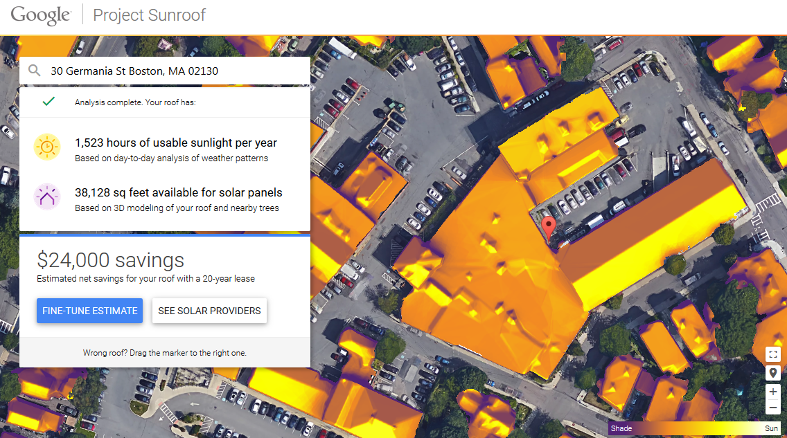
Solar panels are a costly venture that’ll often sets one back thousands of dollars, with years to go before the investment is recouped. The process can turn out be infinitely worse if your roof cannot capture enough sunlight to justify the cost by reinserting excess power into the grid to save money on the electronic bill. Luckily, Google Maps has initiated a new service that integrates satellite imagery and sunlight data for every visible property, forecasting all possible sun positions over the course of the year, historical cloud patterns that may affect solar production, and the shadows cast by nearby buildings or trees.
Titled Sunroof, the feature is a “treasure map” for green energy projects, informing users of exactly how much solar energy shines strikes their building on a daily basis and what kind of savings this figure translates too, as well as how long it’ll take to earn back the initial expense.
At the start, Sunroof is only available in San Francisco, Fresno, and Boston, with potential to expand and encompass the remaining country and/or world “if it is successful.” What designates a measure of success is unknown, as Google claims that Sunroof will not share address with potential hardware retailers.
If you live in one of the selected areas, using the service is as easy as typing in your address, and the service automatically calculates the amount of money saved before listing all the local solar panel installers. Better yet, Sunroof calculates the roof’s total usable square footage for installing solar panels and compares the money saved of leased hardware vs purchased.
Source: Engadget
Advertisement
Learn more about Electronic Products Magazine