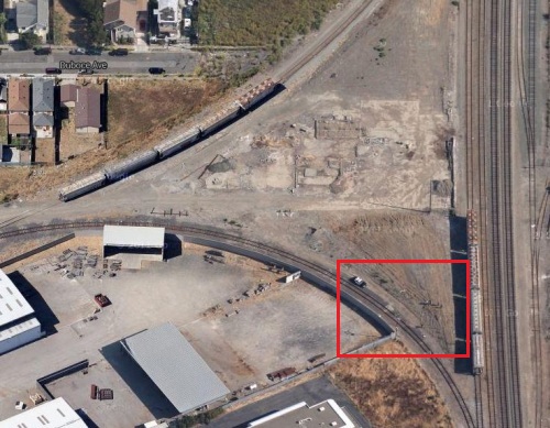
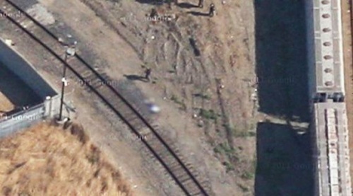
Following a request made by the devastated family of a murdered 14-year-old boy, search giant Google has agreed to replace a section of Richmond, California satellite imagery that clearly shows police standing around the teenager's deceased body.

An overhead look of the crime scene.

Focusing features allow users to zoom in on the crime scene; the boy’s body has been blurred out.
Kevin Barrera’s body was found in 2009 badly beaten and shot to death. To this date, the murder has never been solved.

Kevin Barrera via KTVU.
Jose Barrera, the boy’s father, learned this past week that Google’s Maps service has a satellite image of the murder scene. Upon verification, he put in a formal request with the search and technology giant asking that it be removed.
In response to the request, a Google spokesperson said that while the company normally does not address image replacement requests right away, it would make an exception for Mr. Barrera’s note due to the highly sensitive nature of these circumstances.
“Our hearts go out to the family of this young boy. Since the media first contacted us about the image, we’ve been looking at different technical solutions,” read a company statement.
“Google has never accelerated the replacement of updated satellite imagery from our maps before, but given the circumstances we wanted to make an exception in this case.”
Google technicians estimate that they will have a new image up within eight days.
“When I see this image, that's still like that happened yesterday,” Mr. Barrera told local television station KTVU. “And that brings me back to a lot of memories.”
For those curious about the service, Google Maps stitches together a vast selection of images collected by both satellite and at street level by cameras mounted on vehicles. The latter service is fairly new and so the images tend to be a bit more up to date. Satellite images, however, are not updated often, and tend to be between one and three years old.
And while Google has a facility set up to handle complaints about street level images used in its Mapping services (mostly breech of privacy complaints ranging from blurring out an individual’s face to a car owner’s license plate), since not as many complaints are brought in about the captured satellite images, Google has never set up a department to handle the matter.
Story via: dailymail.co.uk
Advertisement
Learn more about Electronic Products Magazine


