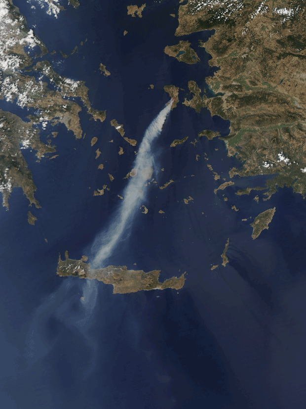
Image of the Day: Aqua Satellite View of Wildfire on Chios
August 22, 2012

NASA image courtesy Jeff Schmaltz, LANCE MODIS Rapid Response Team, Goddard Space Flight Center. Caption by Michon Scott.
In mid-August 2012, an intense wildfire broke out on the Greek island of Chios, sending a thick plume of smoke southward toward the island of Crete (Kriti). The Moderate Resolution Imaging Spectroradiometer (MODIS) on NASA’s Aqua satellite captured this natural-color image on August 18. The red outlines approximate the locations of active blazes.
As of August 21, firefighters—equipped with water-dropping planes and helicopters—were still struggling to control the flames amid strong winds, news sources said. Winds ranged from 62 to 74 kilometers (38 to 46 miles) per hour, Agence France-Presse reported.
On August 21, Ekathimerini reported that the fire had scorched 12,740 hectares (31,480 acres), and the island’s deputy prefect stated that half of Chios had effectively burned. The fire destroyed more than half of the island’s mastic orchards. Mastic is an aromatic resin used in food and cosmetic products. Because mastic resin from Chios has a “protected designation of origin” from the European Union, the fire not only hurt Chios farmers, but also imperiled the world supply of the product. Meanwhile, the Associated Press reported that Chios beekeepers had lost an estimated 60 percent of their hives.
Greece typically sees little rain between April and September and experiences some of its highest temperatures in late July and early August. Wildfires are fairly common in the hot, dry days of August. In 2007, fires on the Peloponnesus Peninsula claimed at least 60 lives, according to news reports.
Advertisement
Learn more about Nasa


