As anyone would suspect, locating and disabling landmines is not only a time-intensive and meticulous task, but a highly dangerous one. According to researchers, it’s estimated that there are 110 million landmines buried around the globe, with more than 70 people killed or injured each day by these explosive devices. To help keep the innocent out of harm's way, British scientists are developing drones with advanced imaging technology to more effectively map and speed up the clearing of affected areas.
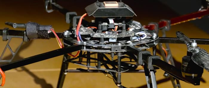
Image via Gizmag.
Typically, flying a drone over a football stadium would stir up an outrage, but earlier this month at Old Trafford in Greater Manchester, England, an unmanned aircraft was allowed to do just that as researchers demonstrated the potential of an airborne approach to landmine detection.
Funded by Manchester United’s Sir Bobby Charlton, the Find A Better Way charity has been looking to advance technologies since 2011 in order to enable safer and more efficient clearance of landmines. The researchers estimate that removing the landmines scattered around the world will cost $30 billion, and could take more than 1,000 years. The plan is to significantly cut these numbers by fitting drones with hyperspectral imaging technology to identify where mines are buried.
“Flying over the Manchester United pitch will demonstrate that we can map a football pitch-sized area of land in two hours or less,” said John Fardoulis, project researcher from Bristol University. “Clearing a minefield that size can currently take months, and the maps our drones will generate should help deminers focus on the places where mines are most likely to be found. This will speed the process up and make the demining significantly safer.”
The drone that flew above Old Trafford snapped hi-res images to clearly show the terrain and objects on the ground. If the team’s hyperspectral imaging drones come along as expected, they’ll be capable of performing flyovers and gather images at various wavelengths, or colors, of light, which could indicate explosive chemicals seeping from landmines.
“Living plants have a very distinctive reflection in the near infrared spectrum, just beyond human vision, which makes it possible to tell how healthy they are,” said Dr. John Day from the University of Bristol. “Chemicals in landmines leak out and are often absorbed by plants, causing abnormalities. Looking for these changes might be a way of discovering the whereabouts of mines.”
According to the researchers, the infrared imaging can expose unexploded and camouflaged mines that would otherwise go undetected.
The British research effort began in January 2016 and will continue for two years. Currently the team is developing the technologies to work with commercially available drones, along with a plan to make the devices affordable and accessible in developing countries.
Source: Gizmag
Advertisement
Learn more about Electronic Products Magazine