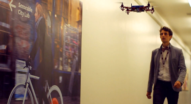
When the word “drone” appears in discussion, one immediately thinks about its usage in zones of warfare or surveillance. Would you ever think about using drones on-campus as tour guides? At first, it doesn’t seem like the proper setting, but it could definitely work. The innovative minds at MIT have employed the use of on-campus drones to help lost students find their way around campus. The above video displays a more educational meaning of how drones can be used to benefit citizens in a city setting through the Skycall app.
The EmTech team of developers at Massachusetts Institute of Technology’s Senseable City Lab has developed a Skycall system to guide lost students around campus. The Skycall program calls upon drones to act as tour guides, leading students to their on-campus destinations. Through a system that uses sensor technology, Skycall enables students to become more acquainted with their surroundings. The lab team analyzed unmanned aerial vehicle (UAV) technology, and applied the team's knowledge to how a quadcopter can freely sense and analyze its environs, and interact with humans on-campus via Skycall.

Image via Skycall
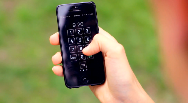
Skycall was created as a human/UAV interface. Skycall is a mobile app that when downloaded activates the GPS information of the user to locate who is in need of a campus-drone guide. Once activated, the quadcopter guide drone flies to the person and wirelessly communicates through its audio system. The user is then asked to enter the desired building code and room number through the app. Next, the quadcopter starts moving at a reasonable pace towards the destination, allowing the person to follow behind. The sensors in the drone will identify the gait of the walker, and will slow down or speed up accordingly. The user can also ditch the drone or stop the tour through the app at any time.
The quadcopter has onboard cameras, autopilot and GPS navigation capabilities, sonar sensors, and Wi-Fi connectivity. The cameras relay the recorded images to a base location. The manually-controlled camera is also accessible to the user via the Skycall app.

Image via Skycall
The Senseable City Lab team displayed their At the SkyCall presentation, Chris Green explained that “rather than the visitor diverting their attention to a map, the autonomous guide provides an intuitive navigational system of simply ‘following’.”
The project’s website states that “a larger development program is currently underway at Senseable City Lab, with the broader aim of exploring novel, positive uses of UAV technology in the urban context.” The lab is still discovering ways that UAV technology can be used more readily in society.
Story via Skycall
Advertisement
Learn more about Electronic Products Magazine


