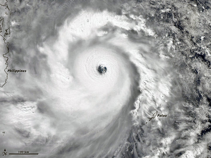
Super Typhoon Haiyan, one of the strongest storms to ever be recorded on the planet, slammed into the Philippines this morning. As the powerful 200-MPH winds roared across the cluster of islands, 100,000 people took shelter in evacuation centers and hundreds of flights were canceled. TV broadcasts have been filled with warnings and advice, but the Internet is where many people are seeking help.
As it often does in times of disaster, web giant Google prepared a crowdsourced crisis response map for Filipinos looking to track Haiyan and the destruction it's caused. The map also shows the landslide and flood-prone areas in the country and includes information on hospitals, evacuation centers and command posts close to the affected areas.

Google's crowdsourced crisis response map. Image via Mashable.
Google's crisis response map can also help out organizations looking to provide relief goods. The information on the map is a joint collaboration between various Google volunteers across the country and collated information from government departments.
Twitter is being used by many Filipinos and organizations to actively reach out by using hashtags to share weather information, emergency numbers, and photos and videos of affected areas. Popular hashtags being used are #RescuePH if someone needs to be rescued, #FloodsPH to report a flood, and #ReliefPH for those who are in need of goods.
The Philippine government's Twitter account, @GovPH, has been actively tweeting and retweeting rainfall advisories and calls for volunteers.

Satellite image of Typhoon Haiyan. Image via NASA.
Have more information to share? Leave a comment below.
Story via Mashable.
Advertisement
Learn more about Electronic Products Magazine


