The Hurricane Imaging Radiometer, known as HIRAD, will fly aboard one of two unmanned Global Hawk aircraft during NASA's Hurricane Severe Storm Sentinel or HS3 mission from Wallops beginning August 26 through September 29.
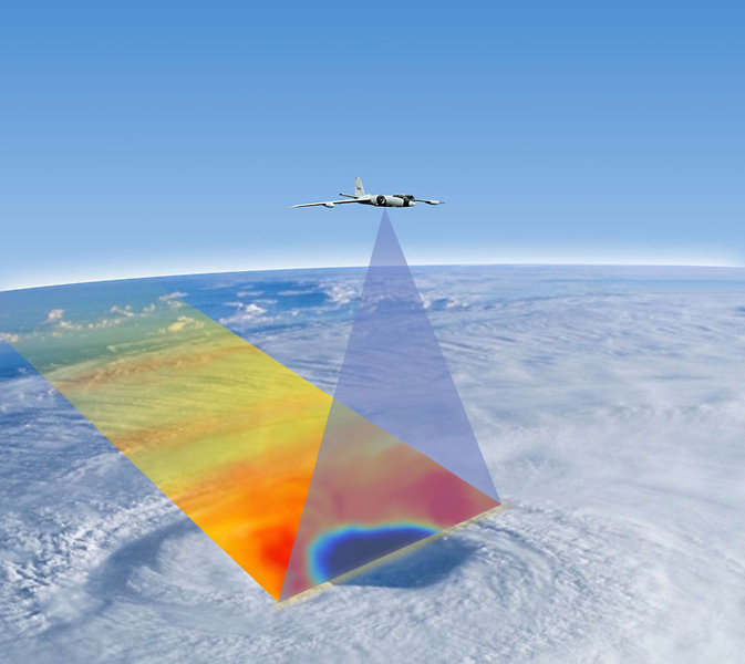
Artist's concept of aircraft with HIRAD scanning a tropical cyclone. Image Credit: NASA
One of the NASA Global Hawks will cover the storm environment and the other will analyze inner-storm conditions. HIRAD will fly aboard the inner-storm Global Hawk and will be positioned at the bottom, rear section of the aircraft.
“HIRAD’s purpose is to map out where the strongest winds are in a hurricane. During its first deployment in 2010 for the GRIP airborne campaign, HIRAD had two interesting hurricane cases, Earl and Karl,” said Daniel J. Cecil, the principal investigator for the HIRAD instrument at NASA's Marshall Space Flight Center, Huntsville, Alabama. “We have made improvements to the instrument since then, and are looking forward to the next good case – out over water, avoiding land of course!”
What is HIRAD?
HIRAD is a passive microwave radiometer that was developed at NASA Marshall. A radiometer is an instrument used to measure the power of electromagnetic radiation. Because HIRAD is a passive microwave radiometer it detects microwave radiation naturally emitted by Earth. The radiation HIRAD detects is then used to infer wind speed at the surface of an ocean.
The antenna on HIRAD makes measurements of microwaves emitted by the ocean surface that are increased by the storm. As winds move across the surface of the sea they generate white, frothy foam. This sea foam causes the ocean surface to emit increasingly large amounts of microwave radiation, similar in frequency or wavelength, but much lower intensity, to that generated within a typical home microwave oven. HIRAD measures that microwave energy and, in doing so, allows scientists to deduce how powerfully the wind is blowing. With HIRAD’s unique capabilities, the two-dimensional structure of the surface wind speed field can be much more accurately determined than current operational capabilities allow.
What information does HIRAD provide?
HIRAD provides unique observations of sea surface wind speed, temperature and rain. The data HIRAD gathers will advance understanding and predictability of hurricane intensity. HIRAD's data will also help better determine maximum wind speed and structure of the vortex (spinning center). The region of strongest winds are also much better observed with HIRAD than current capabilities.
When HIRAD makes cross track scan, it reads a swath of passive microwave radiation emitted from Earth. HIRAD btains measurements of rain rates and hurricane-strength winds, even through heavy rain. HIRAD measures rain rates ranging from ~ 5 to 100 millimeters per hour (0.2 to 3.9 inches per hour) and wind speeds ranging from ~10 to 85 meters per second (22.3 to 190.1 miles per hour / 36 to 306 kilometers per hour).
How is the data visualized?
The HIRAD instrument provides “brightness temperature data” that is color-coded by the HIRAD team at NASA Marshall. That color-coded data shows areas of falling rain and possible moderate-to-strong surface winds.
Advertisement