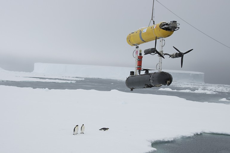
A team of scientists funded by the National Science Foundation have successfully produced the first high-resolution, three-dimensional map of a portion of the Antarctic sea ice thanks to an autonomous robot called SeaBED. SeaBED mapped a distance of 500,000 square meters (5.4 million square feet) under sea-ice floes in three previously inaccessible areas off the Antarctic Peninsula: Weddel, Bellingshausen, and Wilkes Land. SeaBED’s deployment revolutionizes our ability to conduct underwater measurements and observe large-scale changes in sea ice, marking an important step forward in establishing a new best practice. Its findings, which appear in a research paper published in the journal Natural Geoscience , reveal a thickness in the submerged portion of the ice that’s in excess of measurements previously recorded using ice drilling and ship-based measurements.
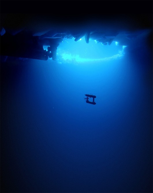
Unlike prior surveying tools, SeaBED uses upward-facing sonar to accurately map ice directly above its position, indicates Woods Hole engineering scientist Hanumant Singh, whose lab designed, built and operated the robot. Prior techniques relied on a “point-based” method of drilling hundreds of holes atop the ice or by estimates deduced from satellite observation — both of which are mercy of snow cover on the ice and nowhere near as detailed or reliable as SeaBED’s maps. SeaBED’s method is more like inspecting the ripeness of an avocado by prodding its skin.
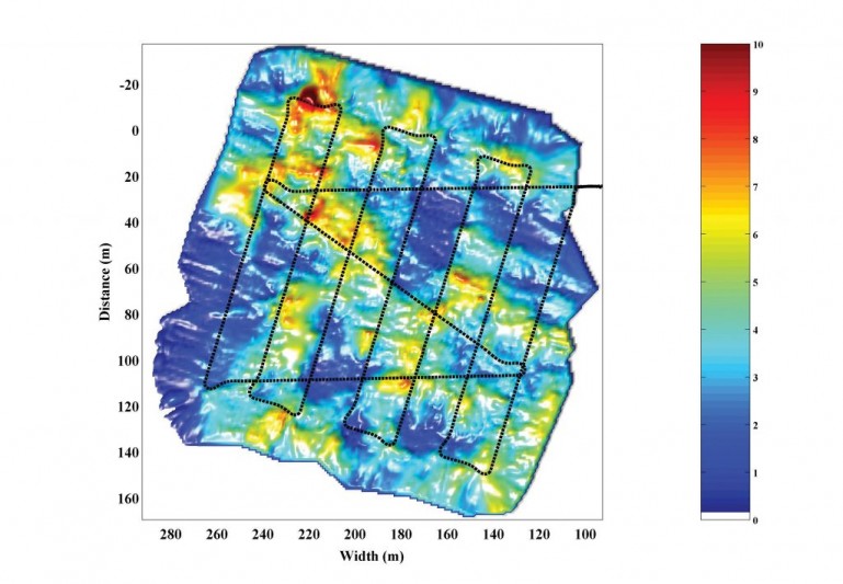
The robot measure 2 meters (6 feet) in length, weights 200 kg (440 lbs) and operates at a depth of 20 to 30 meters (65 to 98 feet) below the ice, moving in a lawnmower-like pattern at a rate of 30 cm/s (12 in/s) while using multi-beam sonar to map the overhead ice in 400 by 400 meter (1,312 by 13,12) sections. Maps are drawn at a resolution better than 25 cm (1 in), according to co-lead author Dr. Guy Williams, which enables the team “to discriminate individual ridge keels and rafted ice blocks.”
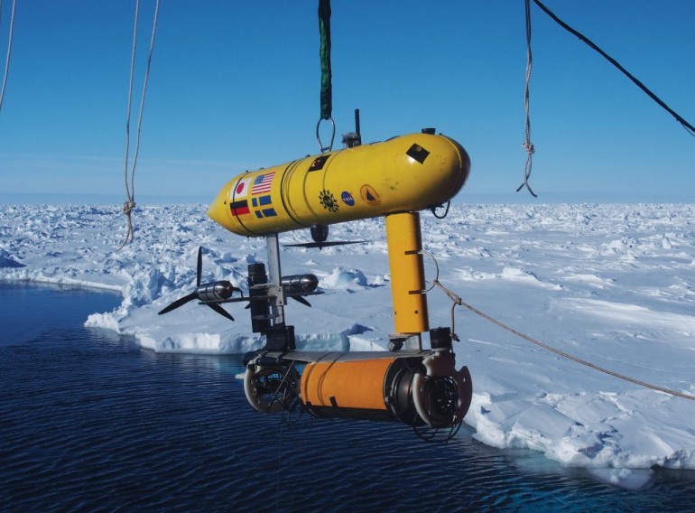
“SeaBED's maneuverability and stability made it ideal for this application where we were doing detailed floe-scale mapping and deploying, as well as recovering in close-packed ice conditions. It would have been tough to do many of the missions we did, especially under the conditions we encountered, with some of the larger [autonomous underwater] vehicles,” indicates Hanumant Singh.
The research team’s next step is to expand the scope of the surveying mission to encompass an even larger area, in the hopes of peering deeper into the nature of Antarctic sea ice and creating a new routine form of underwater monitoring. “We can now measure ice in far greater detail and we're excited to measure ice up to 17 meters thick,” states the study’s co-author Jeremy Wilkinson.
Advertisement
Learn more about Electronic Products Magazine